What Are Earthquake Intensity Measurement: Understanding and calculating the seismic energy released by Earth’s tectonic processes is crucial thanks to Earthquake Intensity Measurement. In the field of seismology, precisely measuring an earthquake’s intensity is essential to determining how it may affect populations and infrastructure. This is a scientific project that requires complex methods that go beyond simple magnitude and investigate the real shaking and possible harm at particular sites.
In addition to providing a numerical scale for seismic events, Earthquake Intensity Measurement helps with the development of efficient disaster response plans and the design of resilient structures. Earthquake Intensity Measurement becomes a vital tool as we explore the seismic subtleties of our globe, bridging the gap between the raw geological forces and their palpable effects on our human environment.
Quick Navigation
What Are Earthquake Intensity Measurement
An Exhaustive Examination of Earthquake Intensity Measurement
In order to solve the seismic riddle that the Earth provides, Earthquake Intensity Measurement, a complex branch of seismology, is essential. In contrast to earthquake magnitude, which measures the total energy released at the source, intensity explores the palpable impacts felt at particular sites. Earthquake Intensity Measurement, its methodologies, importance, and significant impact on emergency response, infrastructure design, and seismic risk management are all discussed in this article.
Read also: 10 Cheapest Self Paced Online College Courses for Credit
Earthquake Intensity Measurement Techniques and Tools
Earthquake Intensity Measurement uses a variety of techniques to account for the intricacy of seismic occurrences. The Modified Mercalli Intensity (MMI) scale is a commonly employed method that evaluates the measurable impacts of an earthquake on individuals, buildings, and the surrounding environment. The MMI scale, which goes from I (not felt) to XII (complete damage), offers a detailed assessment of the impact’s severity. Scientists gather information by conducting interviews, field surveys, and structural damage studies. They then combine this information to produce intensity maps that clearly show the spatial distribution of damage and shaking.
Furthermore, the European Macroseismic Scale (EMS), which is primarily utilized in Europe, provides an alternate viewpoint. This scale also assesses the consequences of earthquakes, but it does so using different evaluation criteria. The intensity of ground shaking is the main emphasis of the Japan Meteorological Agency Seismic Intensity Scale (JMA) in Japan. These various scales highlight how Earthquake Intensity Measurement is flexible enough to account for regional differences and unique geological features.
Earthquake Intensity Measurement’s Significance
Recognizing the role of Earthquake Intensity Measurement in evaluating practical ramifications is essential to appreciating its importance. Intensity focuses on the specific impacts of an earthquake, whereas magnitude gives a general idea of its strength. Based on the extent of the damage, emergency responders and disaster management organizations use this information to prioritize and distribute resources. In addition, Earthquake Intensity Measurement plays a crucial role in designing resilient infrastructure.
Read also: Best Vineyards for Australasian Wines
Practical Applications: Emergency Management
Following a seismic event, prompt and well-informed decision-making is essential. Earthquake Intensity Measurement serves as a compass for emergency personnel, directing them to the most vulnerable places. Rescue teams can quickly mobilize to a site in the event of an earthquake that registers high on the MMI scale in a specific region, indicating significant shaking and potential damage. This allows for a more focused and effective response. For reducing mortality and maximizing resource deployment in the chaotic aftermath of an earthquake, accuracy in Earthquake Intensity Measurement is crucial.
Influences on Building Construction and Design
Particularly in areas where seismic activity is likely to occur, the profound impact of Earthquake Intensity Measurement may be seen in how it affects building design and construction procedures. Engineers use historical earthquake intensity data to guide the construction of structures that can survive different magnitudes of ground shaking. For example, in order to absorb and disperse seismic energy, a high-intensity earthquake may require the installation of additional seismic reinforcement in buildings, such as base isolators or dampers.
Planning for Strategic Land Use
Earthquake Intensity Measurement is important for planning land use in seismically vulnerable locations in addition to individual buildings. Policymakers and urban planners use intensity data to identify seismically risk-prone zones. Stricter building rules are frequently applied to higher intensity areas, which restricts the construction of specific building types that can be more susceptible to seismic effects. Using a strategic approach to land-use planning is essential to building communities that are resilient enough to face the difficulties presented by earthquakes.
Read also: 21 Free Summer Programs for High School Students
Difficulties in Predicting Earthquake Intensity
Even with the advances in seismological study, accurately anticipating an earthquake’s exact intensity ahead of time is still a difficult task. While the likelihood of seismic activity in a specific place can be estimated using probabilistic seismic hazard assessments, it is difficult to predict the exact strength and timing of an earthquake. This intricacy is a result of the complicated interactions between many geological elements and the dynamic character of plate tectonic motions. Although greater research and technical developments might strengthen our forecasting abilities, earthquake intensity prediction is still more of an emerging field of study than a precise one at this point.
International Cooperation in Seismic Science
Geopolitical boundaries do not apply to Earthquake Intensity Measurement. Our understanding of seismic events has advanced because to the global cooperation of scientists and researchers. Standardized measurement scales, cooperative research projects, and shared data all help to make the assessment of earthquake intensity more thorough and precise. This worldwide strategy improves our capacity to foresee, address, and lessen the effects of seismic events on a larger scale.
Earthquake Intensity Measurement: Technological Advances
Earthquake Intensity Measurement skills have been considerably improved by technological advancements. With their advanced sensors and connectivity capabilities, modern seismometers can provide data on ground shaking in real time. Rapid reaction times and more precise assessments of the developing situation are made possible by this instantaneous information. Moreover, remote sensing technology and satellite pictures support a thorough comprehension of the wider effects of seismic events, enabling more efficient disaster response plans.
Earthquake Intensity Measurement’s Future
The future of Earthquake Intensity Measurement seems promising as science and technology advance. We should be able to assess and forecast earthquake strength better with further research in seismology, data analytics, and predictive modeling. Consequently, this will foster the advancement of more robust infrastructure, better emergency response plans, and increased readiness for disasters in areas vulnerable to earthquakes.
additionally:
Our attempts to manage and lessen the effects of seismic disasters are fundamentally supported by Earthquake Intensity Measurement. Its influence is felt in many aspects of our life, from disaster response to architectural design and international cooperation. Earthquake Intensity Measurement is a field that is always developing as we strive to understand the mysteries of Earth’s earthquakes. It helps to build human resilience against one of nature’s most potent forces.
Read also: Manipal Academy of Higher Education – Ranking, Courses, Tuition, Scholarships
What distinguishes an earthquake’s magnitude from its intensity?
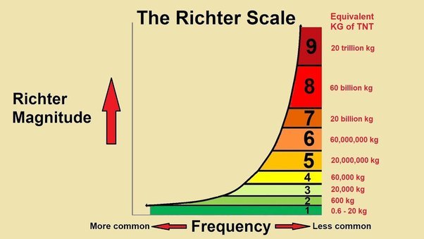
Seismic Activity Level Magnitude and measurement are two different yet related ideas. A quantitative indicator of an earthquake’s overall power, magnitude measures the energy released at the source of the event. The scale is logarithmic, meaning that an increase of one full number corresponds to a tenfold rise in amplitude. However, earthquake intensity explores the impacts felt in particular places. By quantifying the degree of ground shaking and possible damage in a specific place, it provides a qualitative evaluation of the impact of the event on the surface of the Earth. Essentially, intensity defines the effects of an earthquake, whereas magnitude describes its power.
How can scientists quantify an earthquake’s intensity?
The Modified Mercalli Intensity (MMI) scale is one of the techniques used in Earthquake Intensity Measurement. This scale evaluates observable impacts on individuals, buildings, and the environment. The impact severity is given in detail, ranging from I (not felt) to XII (complete damage). Through interviews, field surveys, and structural damage studies, scientists collect data. Seismometers also capture ground motion, which adds to our knowledge of an earthquake’s overall severity. Scientists develop intensity maps that show the spatial distribution of shaking and damage by combining data from these many sources.
Why is measuring earthquake intensity crucial to determining the extent of damage?
For assessing the real-world effects of seismic events, Earthquake Intensity Measurement is essential. While intensity concentrates on the localized consequences of an earthquake, magnitude provides information about the overall power of the event. For disaster management and emergency response, this distinction is essential. Authorities are able to prioritize and distribute resources according to the extent of damage by knowing the intensity. Furthermore, since intensity assessment offers useful information on how structures react to different magnitudes of ground shaking, it helps construct robust infrastructure. Building regulations that lessen the effects of earthquakes must be created and enforced with the use of this information.
Are there other scales for measuring the strength of earthquakes?
Yes, there are various Earthquake Intensity Measurement scales, each with a different methodology. In Europe, in addition to the Modified Mercalli Intensity (MMI) scale, the European Macroseismic Scale (EMS) is widely used. Although it has a separate set of standards, the EMS also evaluates the impacts of earthquakes. The intensity of ground shaking is measured using a different scale that is unique to Japan, the Japan Meteorological Agency Seismic Intensity Scale (JMA). Notwithstanding these differences, the fundamental idea—to estimate how an earthquake will affect the built environment and the Earth’s surface—remains the same.
Read also: 10 Turkey Scholarships for Bangladeshi students 2024
Can the intensity of an earthquake be predicted beforehand?
Although it is still difficult to anticipate an earthquake’s exact intensity in advance, scientists can assess the likelihood of seismic activity in a certain area. Seismic hazard evaluations use seismological and geological data to pinpoint earthquake-prone locations. We are currently unable to anticipate the exact timing and strength of an event, though. While future improvements in data analysis and monitoring technologies may lead to more accurate predictions, for now, predicting earthquake strength is still more of a probabilistic estimate than a precise science.
How does building design and construction in seismically vulnerable places get affected by our understanding of earthquake intensity?
Building design and construction methods in earthquake-prone areas are strongly influenced by Earthquake Intensity Measurement. Seismic construction rules are based on information gathered from previous earthquakes, such as the magnitude of the ground shaking and the damage that resulted. With this knowledge, engineers may create structures that can resist different magnitudes of seismic activity.
The objective is to reduce harm and guarantee occupant safety in the event of an earthquake. Understanding earthquake intensity has an impact on land-use planning as well since certain forms of construction may not be allowed in places with a higher seismic risk. In general, the integration of seismic intensity data into the design process improves infrastructure resilience and lowers the likelihood of disastrous outcomes during seismic occurrences.
When trying to understand the complex dynamics of seismic events, Earthquake Intensity Measurement is a crucial instrument. Its importance in building safer and more resilient communities in earthquake-prone areas is highlighted by its role in leading emergency responses, assessing damage, and influencing construction practices. Our comprehension of earthquake intensity will keep developing, as will our capacity to lessen the effects of these natural occurrences on the constructed environment.
Read also: American University of Sharjah – Ranking, Courses, Tuition, Scholarships 2024
See also:
Trust you found our article on What Are Earthquake Intensity Measurement helpful. Follow our website for more interesting articles.